Trip ideas · Normandy and the Brittany coast
Normandy and the Brittany coast: a One-Week Road Trip From the UK
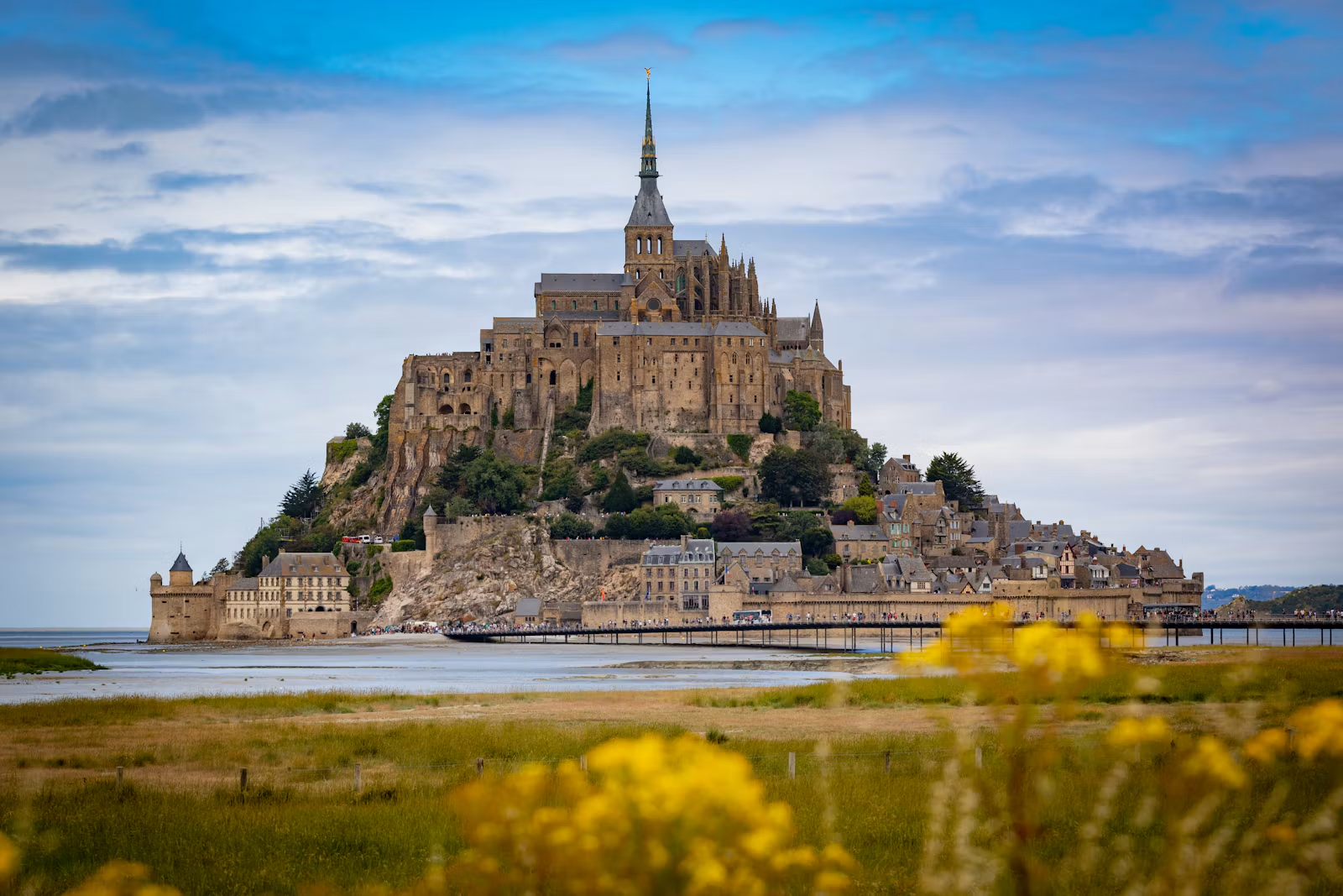
Best in June, also good in July and August
From Dover and back: seven nights, 1,166 km, the longest day about 3 h at the wheel. Driving costs €400–€500 + 2 tolls not priced.
L'Armada de Rouen: tall ships on the Seine: 17–27 June 2027. Watch for: Bayeux Tapestry museum closed for renovation; reopening expected October 2027.
Use this route in my plan Your checklist for United Kingdom, France: vignettes, zones, kit and dates.
Day by day
Kilometres and hours are motorway estimates between the cities named, without stops or traffic. Where you sleep in a smaller place nearby, the real place and its distance are given.
Day 1
Dover → Rouen 229 km · about 2 h 40 driving · plus LeShuttle through the Channel Tunnel
Seine port city; cathedral light show in summer, Armada in June 2027. Source
Day 2
Rouen → Caen 133 km · about 1 h 45 driving
Base for the D-Day beaches and Bayeux. Source The place itself: Bayeux / D-Day landing beaches, about 30 km (approx).
Day 3
A day for Bayeux / D-Day landing beaches No long drive
Day 4
Caen → Rennes 190 km · about 2 h 10 driving, plus the way back from Bayeux / D-Day landing beaches
Walled corsair port Saint-Malo and the bay of Mont-Saint-Michel. Source The place itself: Saint-Malo (Mont-Saint-Michel day trip), about 70 km (approx).
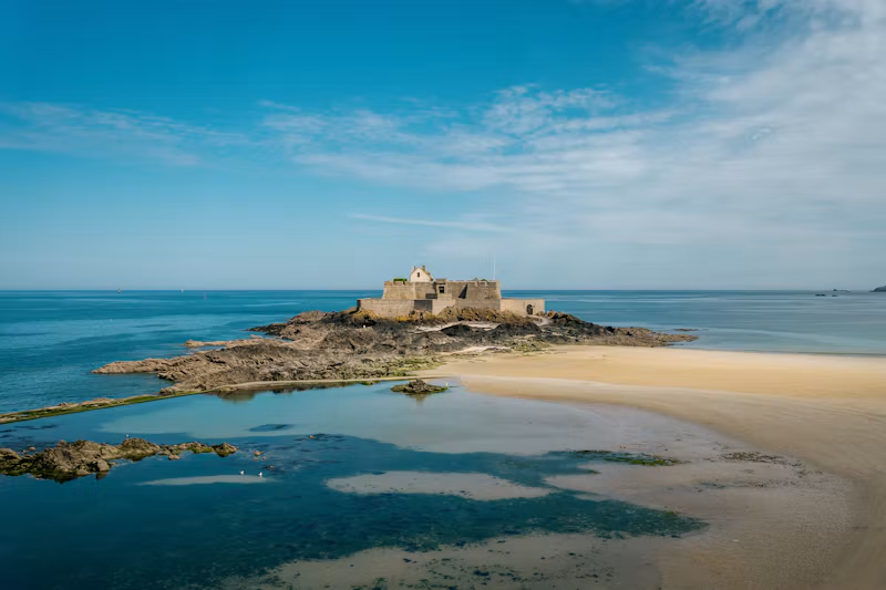
Photo: Thanh Ly / Unsplash Day 5
A day for Saint-Malo (Mont-Saint-Michel day trip) No long drive
Day 6
Rennes → Caen 190 km · about 2 h 10 driving, plus the way back from Saint-Malo (Mont-Saint-Michel day trip)
Harbour town on the Seine estuary, walkable centre. Source The place itself: Honfleur, about 65 km (approx).
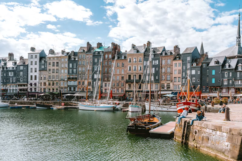
Photo: Sitraka / Unsplash Day 7
Caen → Amiens 249 km · about 3 h driving, plus the way back from Honfleur
Cathedral city; last night ~160 km from Calais. Source
Day 8
Amiens → Dover 175 km · about 2 h 10 driving · plus LeShuttle through the Channel Tunnel
Why go in June
- L'Armada de Rouen: tall ships on the Seine: 17–27 June 2027. Source
- 83rd anniversary of D-Day and the Battle of Normandy, D-Day Landings sector: 29 May – 13 June 2027. Source
- Rouen Cathedral light show (free, nightly): 29 May – 26 September 2026; 2027 dates not published yet. Source
What to watch for
- Bayeux Tapestry museum closed for renovation; reopening expected October 2027 (1 Sept 2025 – c. Oct 2027). Source
- Rouen ZFE: Crit'Air 4, 5 and unclassified cars banned from driving/parking in 13 communes; all cars need a Crit'Air sticker (since 1 Sept 2022). Source
- Mont-Saint-Michel: tourist centre beside the mainland car parks; shuttles or a 40-minute walk to the Mount (all year). Source
What the week costs to drive
| Item | Cost | Worked out from |
|---|---|---|
| Fuel for 1,166 km | €129–€221 | Each country's average petrol and diesel price (week of 28 September 2026), 5 to 8 litres per 100 km. Fuel prices |
| Tolls | €42 | A16 Boulogne Est (Herquelingue) – Abbeville Nord €9.30 Source; A13 Rouen Les Essarts / Maison-Brûlée – Caen (each way) €10.50 Source; A29 Neufchâtel-en-Bray – Amiens Sud (Dury) €6.80 Source; A16 Amiens Sud (Dury) – Boulogne Est (Herquelingue) €15.80 Source |
| Crossing, both ways | €234 | DFDS Dover–Calais ferry (alternative: LeShuttle from £124 each way): £99 each way is the published lowest fare; yours depends on the date and time. Source |
| Driving the week | €400–€500 + 2 tolls not priced | Rounded to €10 |
Not included: A28 Abbeville – Rouen (operator); Pont de Normandie (only if routing Honfleur–Le Havre) (operator); hotels, food and parking. For your own car and exact days, use the trip cost calculator.
The rules on this route
Driving in Britain and Ireland · Driving in France
Use this route in my plan to get every vignette, zone, kit rule and deadline for these countries in one checklist, with dates. The speed limits and sign words pages can then show only these countries.
Next on the road
Sources
- L'Armada de Rouen: tall ships on the Seine
- 83rd anniversary of D-Day and the Battle of Normandy, D-Day Landings sector
- Bayeux Tapestry museum closed for renovation; reopening expected October 2027
- Rouen ZFE: Crit'Air 4, 5 and unclassified cars banned from driving/parking in 13 communes; all cars need a Crit'Air sticker
- Mont-Saint-Michel: tourist centre beside the mainland car parks; shuttles or a 40-minute walk to the Mount
- A16 Boulogne Est (Herquelingue) – Abbeville Nord
- A28 Abbeville – Rouen
- A13 Rouen Les Essarts / Maison-Brûlée – Caen (each way)
- Pont de Normandie (only if routing Honfleur–Le Havre)
- DFDS Dover–Calais ferry (alternative: LeShuttle from £124 each way)
- Base for the D-Day beaches and Bayeux.
- Walled corsair port Saint-Malo and the bay of Mont-Saint-Michel.
- Harbour town on the Seine estuary, walkable centre.
- Cathedral city; last night ~160 km from Calais.
Dates and prices as published when checked. Events move: check the organiser's page before you book.